

5 Questions with Roanoke Outside.
5 questions with Roanoke Outside about who we are.
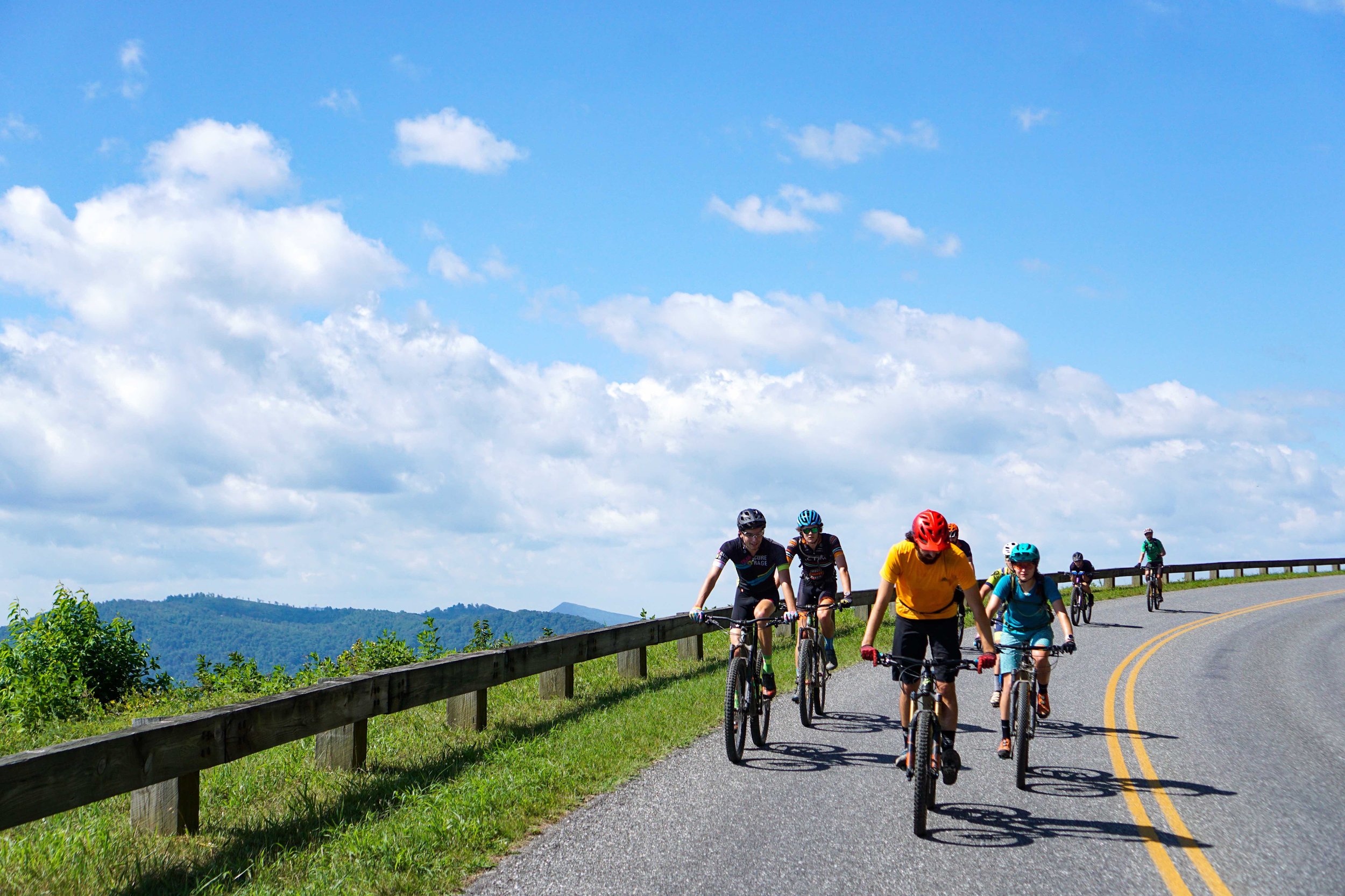
Virginia Blue Ridge Adventures is a guided cycling tour business founded by Roanoke newcomers Kerry and Emily Werner. They moved here in the summer of 2020 and immediately fell in love with the access to high-quality, diverse, and plentiful trails, roads, and hikes that the Roanoke Region has to offer.
The two professional cyclists come from Winston Salem, NC just two hours south of Roanoke. They had traveled to the area to compete in the VBR Go Cross Cyclocross UCI pro bike race. But prior to a spring 2020 visit, they hadn’t known about the gems tucked into the hollers and scattered about the ridges of the Roanoke Valley.
Let’s get to know the Werner’s and learn more about their new venture Virginia Blue Ridge Adventures…

1. Was there a specific ride or moment that spurred this idea?
No, actually quite the opposite. That first year in 2020 it seemed like every ride that we were going on and getting a lay of the land was just fire. It helped cycling feel new and exciting again. We had been in Winston Salem, NC for the past four years and the change of scenery; rolling farmland to proper mountains, and lots of backcountry riding; was just what we needed. So it was more of a build up, not just one great ride that got us here, but almost every ride, spanning the spectrum of mountain biking, gravel, road, and cyclocross.
2. If you could change one thing about the Roanoke Region’s outdoor community, what would it be?
The access and support for outdoor infrastructure in Roanoke is better than any place I have lived before. I just wish more people knew about it! The city itself maintains all the greenways and in-town bike path infrastructure as well as Mill Mountain trails and all the trails at Carvins Cove Reservoir. The City of Roanoke’s recreation department puts on a spring MTB mid-week race series (Disco Race) and a summer mid-week CX race series (Summer Cross). Also, there’s the big Go Outside Festival in October.
If you check Roanoke Outside’s event calendar it’s almost overwhelming how many events are going on. Thanks to all this support from the local government, the community itself is strong and alive. There is a lot of potential for growth. We just have to get the word out, which is partly what we hope to achieve with VBRA.
3. What is VBR Adventures’ mission and how do you plan to give back to the outdoor community?
Simply put we want to share our area with y’all by offering guided cycling tours of various disciplines; custom tours, group events, and private skills sessions. It will span the spectrum of road, mountain biking, gravel, and even bike path cruising around downtown.
In doing this we aim to safely provide all customers with an absolutely awesome riding experience while also giving back to our community. We are going to donate 5% of every trip booked to help build local cycling infrastructure. Why? Because we love the trails, access, and opportunity here in the Roanoke Valley and we want to keep it awesome. Therefore, we feel that the sustainability of our trail networks, bike paths, and community are just as, if not more, important than the enjoyment we get from them. So we are going to use our dollars to keep our area open and accessible.
4. If you could pick one ride to take people on, which would it be?
This is one of those questions that is really hard to answer because there are so many rides in the area that offer something different worth experiencing. The ride that comes to mind is a little ridden area just outside of Catawba, Va. It is a big day but can be split up to ride any of these trails by themselves. I am talking about North Mountain’s Dragon’s Back and the animal trails. The Dragons Back is a 13.8-mile, ridgeline single track and the animal trails are four trail options that drop off the north and south side of the ridge. In the fall when the leaves are on the ground and the undergrowth is matted down, the views of the Roanoke Valley are amazing. It’s cool to see similar views you would see from the Blue Ridge Parkway but from across the valley. The trails are really challenging in terms of elevation gain and technicality but the sense of accomplishment from even doing a 10-mile loop on North Mountain is as high as the ridge itself.

Here is Strava route that allows you to ride all the trails on North Mountain. If completed you have successfully slayed the dragon! Be warned! The 36 miles seems like a small ride but the 8K ft of vert will make this feel like a monster day. Be prepared for a long day.
5. Do you ride mountain bike, road, and gravel? What is your favorite? Do your tours go on any of those terrains?
Our area has a little of everything and we offer private tours and skills sessions in each discipline. We have the Blue Ridge Parkway for those wanting to stick to pavement. We have miles of gravel forest service roads in the two adjacent National Forests, George Washington and Jefferson. On the mountain bike side of the spectrum we have Mill Mountain trails in town, Carvins Cove just on the outskirts of town, and even more enticing are the backcountry routes that will make you feel like you are really out there. Then of course we have Go Cross, a Cyclocross race that takes place at Fallon Park, Southeast Roanoke. Is it on the National Cyclocross Race Calendar and people travel from all over the nation to race it.

I have been really excited about the gravel opportunities surrounding the Roanoke Valley. These rides often provide shelter from heavy traffic, are more engaging than pounding pavement, and can give you more of a sense of adventure without the full-on planning of mountain bike backcountry ride. It’s a good way to get away from the city, your work and personal life, and disconnect. Gravel therapy in a sense.
Bonus Question: How does the world-famous Sherman Shields feel about the Roanoke Valley?
As a beagle who’s sniffed many trails and hiked several mountains, including 14ers in Colorado, Sherman has been stoked. He loves cruising the greenways on bikes or on foot and can’t stop putting his nose to the ground when his paws touch dirt. The Roanoke Valley is two dewclaws up!


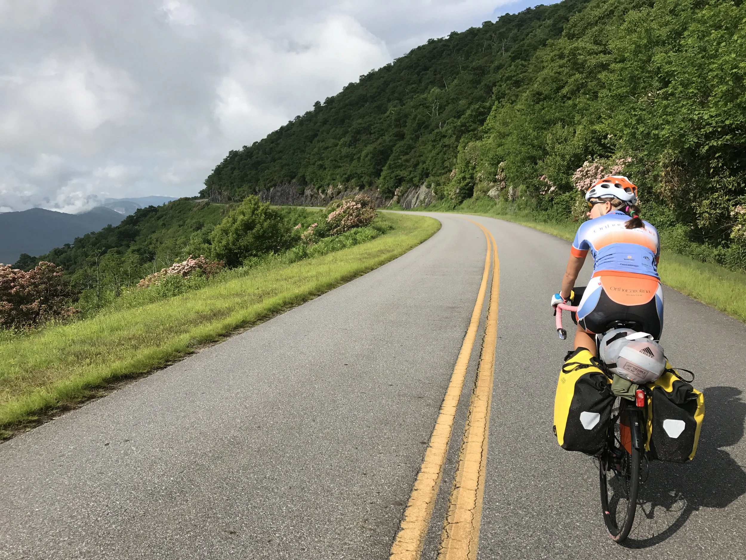
Throwback: Touring the Blue Ridge Parkway
We drove my car with a trailer up to the start and parked at a sketchy run down motel, where an employee told me that "people park here all the time...".
It all started back at the beginning of the 2016 CX season. We were in Madison for the Trek CXC Cup and My host family was telling me about how they would do rides on tandems together because their fitness levels were too askew. This was the spark to set the blaze, which became the idea for my girl friend, Emily Shields, and I to ride the Blue Ridge Parkway. I will preface this story by saying that Emily is by no means slow and our fitness levels aren't that far off. I just wanted us to go on an adventure together and the idea of riding a tandem sounded like the best way to do that. (phew... narrowly missed that one!) We quickly realized a tandem may not be the best idea. For one, neither of us had ever ridden one, we didn't have access to one sturdy enough to go bike packing or touring, and maybe most importantly I had heard one too many times from experienced tandem adventurers that "If you make it through the ride with your relationship in tact you should probably marry that girl", I wasn't prepared to risk the other side of that coin. So we got a B.O.B. Yak trailer and a really good friend of our lent us her Ortlieb F&R panniers and handle bar bag (which are rad AF by the way).
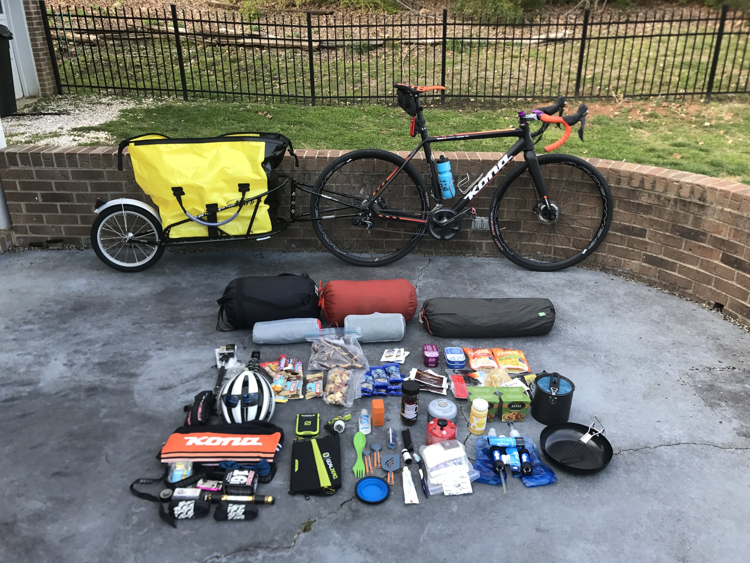
We weren't vain enough to think we could just hop on our bikes, with all this stuff, and complete the parkway no sweat. The Blue Ridge Parkway is 469 miles and stretches from Afton, Va to Cherokee, NC, contains 55K+ of climbing, and, in most cases, to get off the parkway and get to civilization would require a 2-3 mile descent, ergo, a 2-3 mile climb back up, adding at least an hour and wasting precious Kj's. Therefore, we strapped up in March for Emily's Spring break (Masters student at UNCG) and went out for a 3 day trip to acclimatize ourselves to the bike packing lifestyle, dial in our gear list, and make sure the bikes could handle the weight.
Our mini trip was a success and the excitement had now blossomed into a full blown flower the size of "Jack's Bean Stalk". The only thing to do was to wait for the right time. Emily still had to graduate, school... right, and we had some racing to do. We finished up The Transylvania Epic Mountain Bike Stage Race, fit and ready for some adventure with no structure or schedule just bike riding, sight seeing, hiking, becoming more in tune with the Appalachian ridge line I have grown to love.
We drove my car with a trailer up to the start and parked at a sketchy run down motel, where an employee told me that "people park here all the time...".

I would later ride my moto up and trailer it back (always winning!). We turned our backs on my Subaru, possibly to never see it again, and began the 469 mile journey south.
The point of this trip for us was not to get to the end it was to enjoy the journey. In order to help facilitate this attitude we pedaled easy and stopped often. I also planned some extracurricular trips...
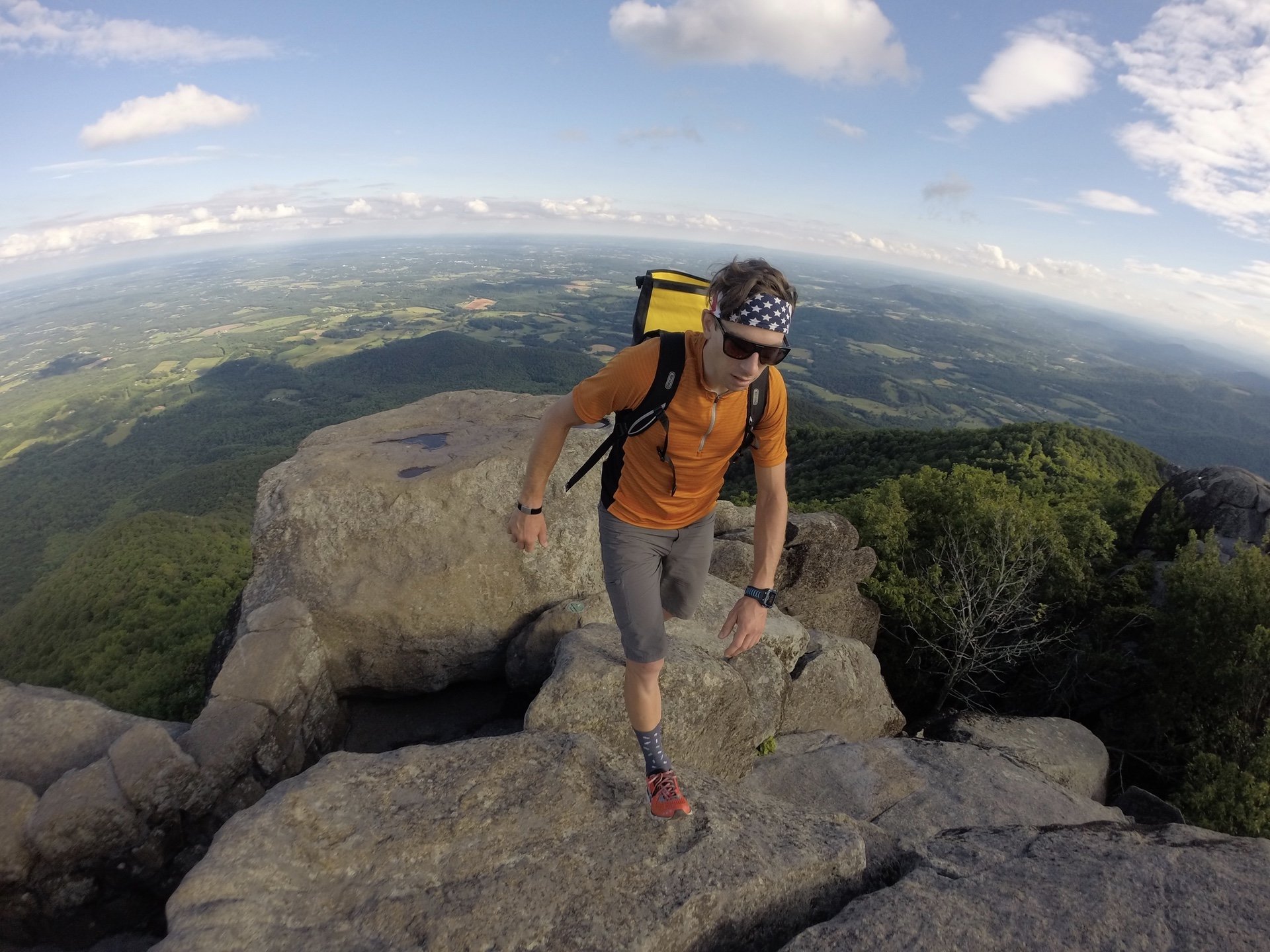
Day two we made it to the Peaks of Otter Campground at mile marker 85ish. After setting up camp we hustled to get to the top of Sharp Top Mountain before it got too late and we were rewarded with an epic panorama of the rolling Virginia ridges, deep valleys, and dense green foliage.
Day 3 ended up being a bit of a long day. We had a luxurious lunch at Roanoke Mountain Campground and from there proceeded south to what I thought would be our campsite. With no water in sight, not even a stream to filter, we kept pushing, which turned the planned 59 miles into 70 miles and 5:15hrs.
It was all good, essentially we "robbed Peter to pay Paul" and turned day 4 into a quickie stopping at the Fancy Gap Campground. With the extra time we had to make it to our stopping point we pulled the rigs into the Mabry Mill Restaurant and had a diner style breakfast, complete with pancakes, eggs, bacon, hash browns, and that stupid little orange slice that diners put on your plate, I guess for decoration? We ate that too.
A lot of the rest stops state "No Trailers" being the hard-asses we are we ignored these signs and whipped my rig in with no regard for the parked cars, motorcycles, or odd looking three wheelers around us.
Day five we started climbing up into the NC high country and crossed over the VA-NC state line. We experienced one last wide open view of Virginia looking south into NC, sitting on hill top perch in Rocky Knob State Park.

Emily's Parents drove their RV to the Doughton Campground, just west of Stone Mountain State Park in NC. They came loaded with all our restocking essentials, more cooking fuel, more Mountain House dehydrated/freeze dried food, loads of Clifbar products, two fresh chamois and jerseys, but most importantly a nice hot shower and a queen bed (yes, Emily and I kicked her parents out of the main RV bed. You would have done the same).
I was feeling great on day 5, we crossed our half way mark and the sleds were the lightest they had been all trip.

Then we loaded up the morning of day 6 and it felt like I was pulling the RV with me down the parkway. We had spent the last 5 day exhausting our supplies and thus our bikes were much lighter. They were back to full weight, which made my legs feel like they were loaded with cement.
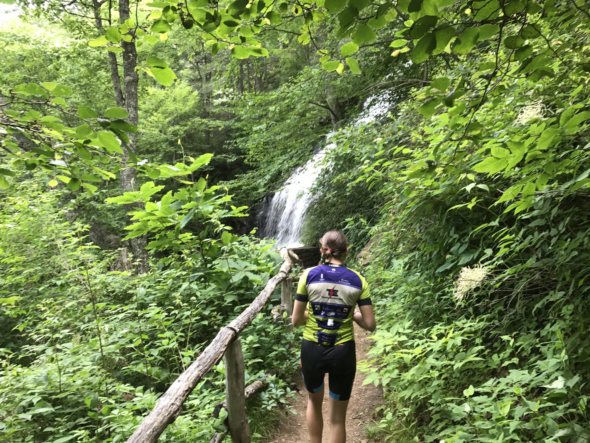
We made it to E.B. Jeffress park, between Stone Mountain and Boone, NC. We took lunch and a small walk, I wouldn't even call it a hike, down into the water fall cascade. It was huge!!!
Before pulling into Julian Price Lake Campground for the night we did one of our only drop offs of the trip and hit Hatchet Coffee in Boone for a bean restock and a final push latte. The Julian Price Campground provided a picturesque spot for dinner, watching the SUP'ers roll across the calm waters.
More adventure on tap for day 7 but not before breakfast.

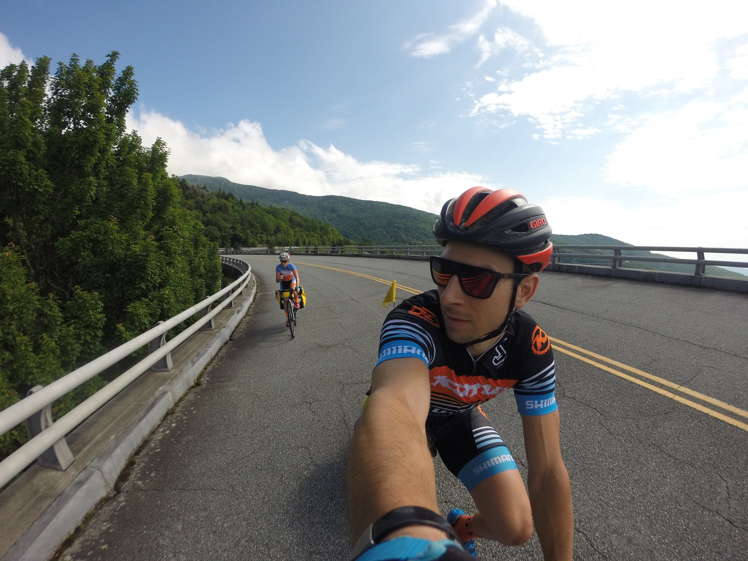
From JPCG we rolled through our home turf of the Grandfather Mountain area of the BRP, crossing the via duct and dropping into Linville Gorge.
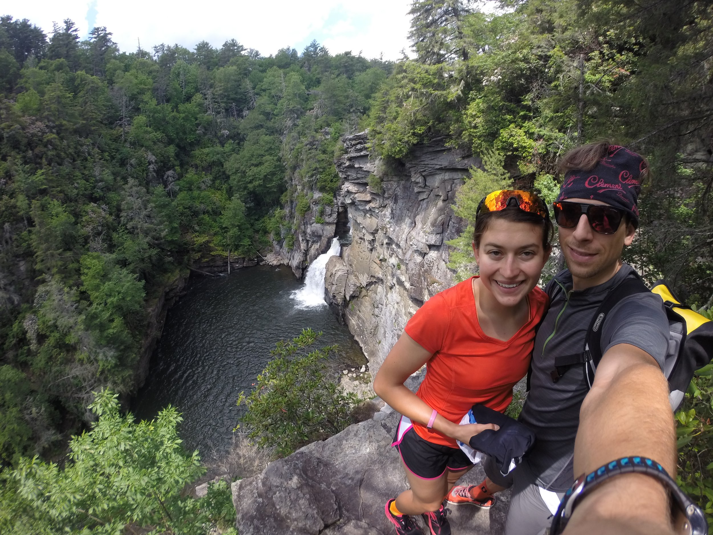
We dropped off the BRP into Linville Falls and spent the afternoon cruising the nearly paved, heavily treaded, hiking trails to the Plunge Basin Overlook and Erwins Overlook.
Time got away from us and we made a hasty exit as dark clouds rolled in. We pushed further south and got caught in our first bit of rain around Little Switzerland. The temps dropped and the sky opened up but it only lasted about an hour.
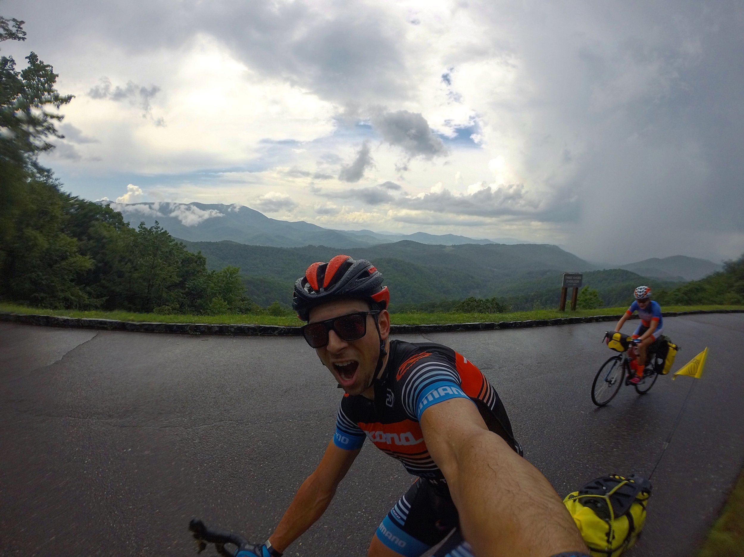
The bags did their job and kept all our gear dry. The sun even managed to come back out as we settled into camp at Crabtree Falls CG.
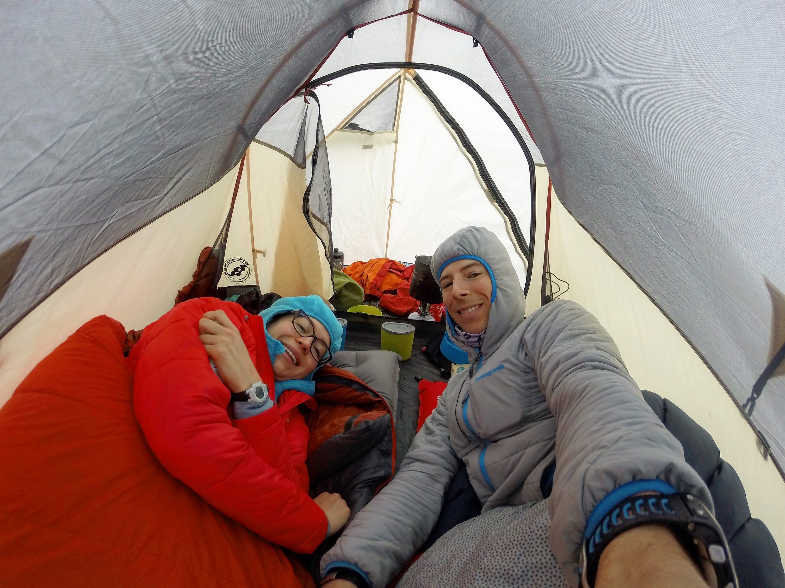
Mornings are always my favorite time, especially when you crawl out of a tent and greet days like this...

Crabtree Falls to Mount Mitchell! The highest peak east of the Mississippi, I wouldn't call it cheating more of a "work smarter not harder" mentality. We dropped our bags at the bottom of the climb (Mount Mitchell is an off shoot of the BRP) and headed up. Instantly, the bikes felt so weird, squirrely and hard to control, but oh lawd they felt light.
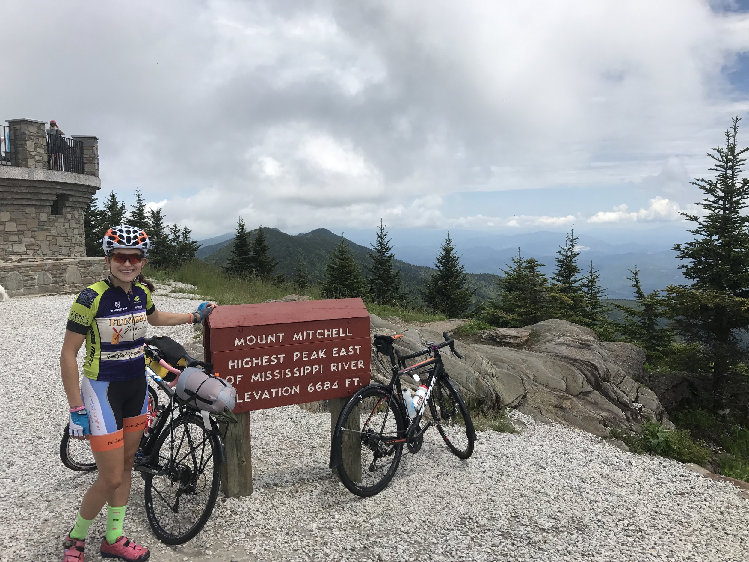
We got to the top and took it all in. It was all down hill from here to Asheville so we grabbed lunch and bombed down to Craggy Gardens. We plopped down in the middle of the overlook, no regard to the people around us and their obvious distain for our chosen location to pop open our white styrofoam lunches and devour, like animals, rubens and sweet potato fries.
It sure was hard to leave but the continued down hill from Craggy Gardens was inviting. We got to the Folk Art Music Center when we ran into a friend of mine, Stephen Janes, who graciously invited us to crash in his unfinished cottage for the night, instead of scouring the woods for an adequate campsite. He and his wife Rhonda provided us with dinner, a washing machine, sleeping quarters, and capped off the night with campfire s'mores. We woke to coffee, biscuits, and eggs followed by a single track lead out by Steve from their home up to the BRP where we bid our farewells (the gnarliest terrain we saw the entire ride).
I spent the first few miles in my own head, contemplating how maybe the world wasn't completely lost to overzealous, greedy, loathing individuals. However, then we were buzzed by an oversized truck and was snapped back into reality.
I quickly fell back into my reverie because people like Stephen and Rhonda can leave a lasting impression. Plus, there too much to see and two days left of BRP to see it.

Day 9 we cruised fast for 30 min then climbed for the next 1.5 hrs up to Mount Pisgah Campground. Camp was set but not before being lectured about increased bear activity in the area. We were instructed, rigorously about putting all food and other fragrant items in the bear boxes, as if I would have left a plate of cookies and jar of honey out on the camp table with a note for any furry, four legged, passerby's.

We waited out an afternoon rain storm then pedaled over to Mount Pisgah's hiking trail.
We were the first ones up to the top after the rain. It was nice to gaze out over the ridges and valleys to come on day 10 in solitude. We lingered at the top trying to point out where we had come from and where we were going, where Asheville was and more importantly where the top of the parkway might lay. It was planned to be 28 miles into our 64 mile day.
We slept soundly, both of us anxious to have the last day upon us but eager to get it over with.
We started day 10 expecting to get rained on. Fortunately, Lady Luck, must have been along for the ride. She very well may have been hiding in my trailer bag because those 20+ miles of uphill or so, from Mount Pisgah 4.980 ft to the highest point on the BRP 6,053 ft, were dauntingly difficult.

From there we dropped like rocks over a cliffs edge, traversing bench cut motor road, winding through dark tunnels, and finally arriving at a bear of a climb up to Waterrock Knob, the last significant climb up to 6045ft.
Once we crested to the Waterrock visitors center we were finished. Only 12 miles from the end and mostly downhill from here, we took our time to have some coffee, lunch, and take it all in one last time before we dropped below 6000+ ft.
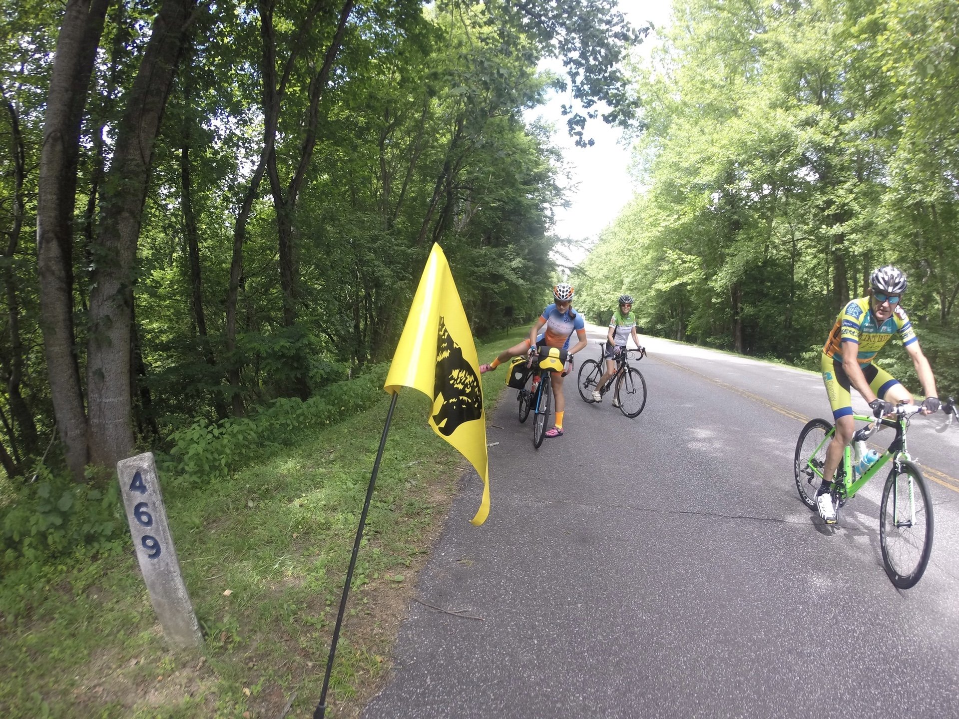
It all became real once we ran into Emily's parents. They had already parked the RV in a campground at the end of the Parkway and were riding back to meet us and finish up with us. Mile Marker 469 came into view and there was no holding back my elation.
I wasn't over the moon with joy for the fact that we finished but more so how the ride went. I knew the pedaling would be easy for us, I mean it's what we do and have done almost everyday of our lives for the past decade or so. I was more enamored with the fact that we took our time, saw more than just the road, never had our emotions dip into critically low points, we maintained an even keel the whole ride and enjoyed every pedal stroke along the way. Thinking about it now I can't describe how lucky we are to have only been rained on once for an hour, never had to set up or breakdown camp in the rain, only had one flat due to a tube malfunction, never were uncomfortable, never hurt, and aside from small quarrels we grew closer together not further apart. The only thing left to do is plan the next trip...